Products
SharedGeo thrives on the challenge of creating unique and affordable approaches to the nation’s most difficult geospatial challenges. For example, when approached by one of the nation’s largest shale oil producers who was looking for way to reduce environmental impact by geospatially optimizing drill site locations and correspondingly reduce use of fracking fluids, SharedGeo created a plugin for the company’s commercial GIS software which automatically calculated the solution for these issues.
Find below some types of products SharedGeo has to offer. Additional examples of SharedGeo capabilities can be found in the “Community Service” and “Projects” sections of this website. SharedGeo also provides consulting; pro bono if appropriate for circumstances.
Data and Imagery Services
Aerial Imagery Delivery – We’re experts at transforming a wide variety of remote sensing data streams into actionable information for units of government and others with this need.
Spatial Data Management – Configuring, managing, uploading and distributing large geospatial data sets at high speed is one of our areas of expertise. Petabytes of data is no problem.
Web Solutions and Open Source Software
Automatic Vehicle Location (AVL) – Cost effective solutions whether the need is turnkey or just the display of your AVL tracking data.
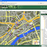
Common Operating Picture Deployments – Nationally recognized expertise in the deployment of Common Operating Picture platforms for government, infrastructure, or general corporate use.
Proximity Finder (spatial query service) – A map driven software solution that allows you to query information about an area, against a specific location (what High School is closest to where I live).
Organization Support Services
U.S. National Grid Support
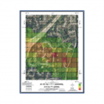
Map Books – In need of a map book based on the U.S. National Grid? If so, we have a solution for everything from first responders to real estate agents. Call us and we’ll tell you about the complete system we built for Iowa Homeland Security and Emergency Management.
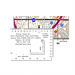
Romer Readers – The latest version of the wallet size, clear plastic grid readers for determining location on U.S. National Grid (USNG) or Military Grid Reference System (MGRS) maps. Available in small numbers or in bulk. Order at the USNG Store.
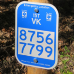
USNG Emergency Location Markers – We invented this product – so from start to finish, no one knows USNG Emergency Location Markers like SharedGeo. Contact us and we will be more than happy to you understand the program and help get you started on your project. A network of vendors and manufacturers now developing across the country are now also available to help. Find information on USNG Information Center and USNG Store.

