SharedGeo Tracks COVID-19 Spread Across the U.S.

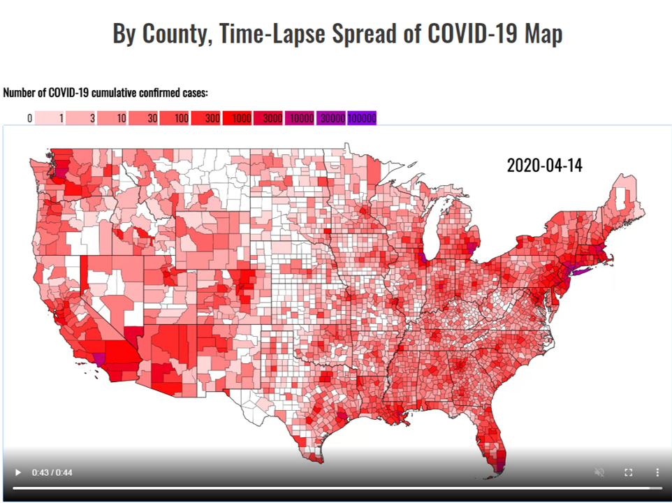
In support of COVID-19 public health awareness efforts, on March 19, 2020, SharedGeo officially launched a web map interface which allows users to visualize the spread of the virus across the U.S. since early March. Unique to the map is a time sequence display of county level data made available by University of Virginia’s Biocomplexity Institute’s COVID-19 Surveillance Dashboard and the Coronavirus COVID-19 Global Cases map by the Center for Systems Science and Engineering (CSSE) at John Hopkins University.
In announcing release of the map, SharedGeo indicated it had two objectives:
1.) To visually demonstrate to U.S. citizens the rapidly expanding nature of the COVID-19
virus so individuals and organizations will take to heart the warnings, precautions, and
preventive measures requested by the Centers for Disease Control and Prevention and
others in the medical and Public Health sectors, and
2.) To start a discussion about the need for better granularity of location reporting when dealing with health crises. Across the spectrum of disasters which can befall a nation,
nothing is more pervasive and debilitating than pandemic. Yet, the critical role which
location intelligence can play in managing these types of situations has been historically
lacking. This remains true despite there being effective ways to provide medically
related location data without violating patient privacy. For an example, see https://usng-gis.org/.
SharedGeo will update the map daily so long as data is available, and the map’s availability is
deemed worthwhile.
To view the map, go here: https://uscovid-19map.org.


No comments