NASA’s Kennedy Space Center Completes Install of SharedGeo’s Emergency Location Marker System
August 1, 2019 by central No Comments

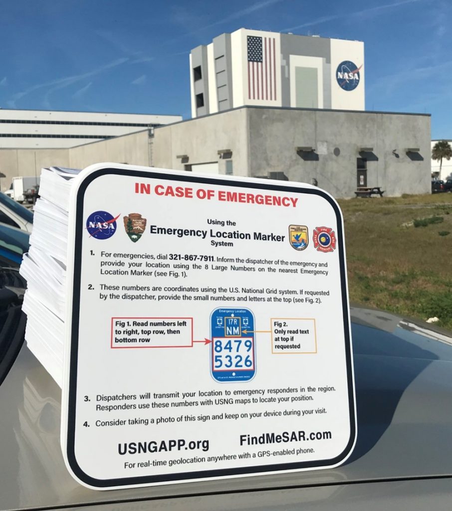
During deliberations in 2018, NASA’s Office of the Chief Technologist, Innovation Without Boundaries panel selected SharedGeo’s Emergency Location Marker (ELM) system for install on the nation’s space center.  In an effort led by Al Studt who serves as the Lead Fire Suppression & Protective Systems Engineer at Kennedy Space Center and as a Lieutenant with the Cape Canaveral Fire Department, SharedGeo worked closely with Kennedy Space Center personnel to develop and deliver ELM’s and informational signs which support the unique needs of this iconic American location visited by more than one million individuals each year.  In addition to placement on Kennedy Space Center proper, ELM’s were also installed on the adjoining U.S. Fish & Wildlife Service’s Merritt Island Refuge and the Canaveral National Seashore.  You can read more about the project here.

SharedGeo Partners to Bring OSGeo Community Sprint to Minneapolis

May 20, 2019 by central No Comments

In partnership with the Open Source Geospatial Foundation (OSGeo) and University of Minnesota, Twin Cities (USpatial), SharedGeo was pleased to be able help organize the Minneapolis OSGeo Community Sprint, which was held May 14-17, 2019, at the University of Minnesota. Developed under the guidance of Steve Lime, Kari Guerts and Howard Butler, the event brought together 40 open source programmers from around the world for four days of collaboration and code improvement of OSGeo projects. Although participants were expected to pay for travel and lodging, meals and entertainments were covered by sponsorship donations from 13 organizations. Prudent money management by the event leads also meant that over $3,000 was sent on to OSGeo for support of the 2020 Community Sprint in Athens, Greece. From all reports, the event was highly successful in terms of software improvement and creation of collaborative connections.

Team Spatial and SharedGeo Partner to Install Nation’s Largest Urban ELM Project

April 19, 2019 by central No Comments


Working in close partnership with Atlanta based geospatial firm Team Spatial, SharedGeo has been integral to implementing a comprehensive emergency response trail marking system covering 100’s of miles of urban recreational trails in Cobb County, Georgia. The combination of SharedGeo’s Emergency Location Marker (ELM) system and Team Spatial’s efforts to enhance location information available in E911 dispatch and responder mobile data terminals has led to the county being recognized for innovation and improved trail safety. The items below provide expanded details of this story:

Technical Director Basques’ Developmental Work Rates as a 2018 Top Ten Geospatial Story

January 10, 2019 by central No Comments

In its annual review of most read stories during the past year, the Geospatial Information & Technology Association announced on December 28, 2018 that an article featuring efforts of SharedGeo Technical Director Bob Basques at the City of St. Paul, Minnesota was one of its top 10 for the past year. The story entitled Open Source Viewer Sharing All City’s Geospatial Data Can Run on Raspberry Pi was published in the well-known geospatial blog Between the Poles, and sequentially picked up by GITA News Hub on March 22 with the following lead in:  

At GITA 2018 in Phoenix, Bob Basques, GIS Systems Developer at the City of St Paul, described a system called COMPASS he and his team have developed that provides a shared, easy to use tool that allows city employees and the public access to all of the City’s spatial and associated data including, for example, scans of surveyors’ notebooks, 2.2 million street level photos, and permitting and licensing information from 200 different applications.

You can read the full article here.

SharedGeo Completes Six Year GITA Service Contract

September 10, 2018 by central No Comments

On September 1, 2018, SharedGeo completed six years of providing all association services for the Geospatial Information & Technology Association (GITA), the nation’s largest geospatial association focused on the infrastructure sector. Recruited in late 2012 to provide association support after the extended economic downturn of the Great Recession of 2008 led to layoff of the GITA’s full-time personnel, SharedGeo was faced with the daunting task of transitioning nearly 32 years of hard copy administrative records and established business practices into online solutions. This required the complete rebuild of GITA’s website and association management system, creation of a collaborative online work environment leveraging Google’s Nonprofit Business suite, significantly expanding the social media platforms, and management of the association’s day-to-day business while also developing or supporting 20 some international, national or regional conferences. SharedGeo was able to provide these services for approximately 15% of what the association had previously paid for these same services.

Upon completion of the contract, SharedGeo turned over service responsibility to Civica Associations Conferences & Exhibitions of Aurora, Colorado.

SharedGeo Once Again Leads Development of the Upper Midwest Geospatial Conference

November 17, 2017 by central No Comments

Following up on creation of the highly successful 2016 Upper Midwest Geospatial Conference (UMGEOCON), SharedGeo is once again spearheading efforts to bring together geospatial professionals from across the Upper Midwest for a unique professional development and learning experience.  In addition to SharedGeo, organizations returning from 2016 are the American Society for Photogrammetry and Remote Sensing – Western Great Lakes RegionGeospatial Information and Technology AssociationIowa Geographic Information Council, Minnesota GIS/LIS Consortium and the Wisconsin Land Information Association. The Illinois GIS Association will be joining the conference for the first time.  

Unlike many state specific or product focused events, UMGEOCON is designed to encourage collaboration and collective learning across county and state borders by geospatial professionals from across the Upper Midwest.

The 2018 UMGEOCON will take place at the University of Wisconsin – La Crosse, May 23-24, 2018.

ERA and SharedGeo Meet to Discuss DragonEye

March 2, 2017 by central No Comments

Recently Executive Director Steve Swazee and Sales Lead Steve Gilkey traveled to the Czech Republic to discuss DragonEye capabilities and potential collaborative business opportunities with executives of Czech aerospace firm ERA. ERA, which specializes in multilateration, multistatic surveillance, and reconnaissance technology, is a subsidiary of Czech defense giant Omnipol.

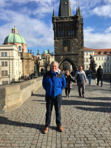
In addition to Director Swazee and Mr. Gilkey having the opportunity to visit ERA headquarters in Pardubice, the two were able to take in some of the sights of this beautiful country.  Picture to left shows Director Swazee at Prague’s Old Town Bridge Tower which began construction in 1357 AD.

You can view a PowerPoint about DragonEye capabilities at this link. (Can be slow to load)

SharedGeo Celebrates Its 8th Birthday!

October 4, 2016 by central No Comments

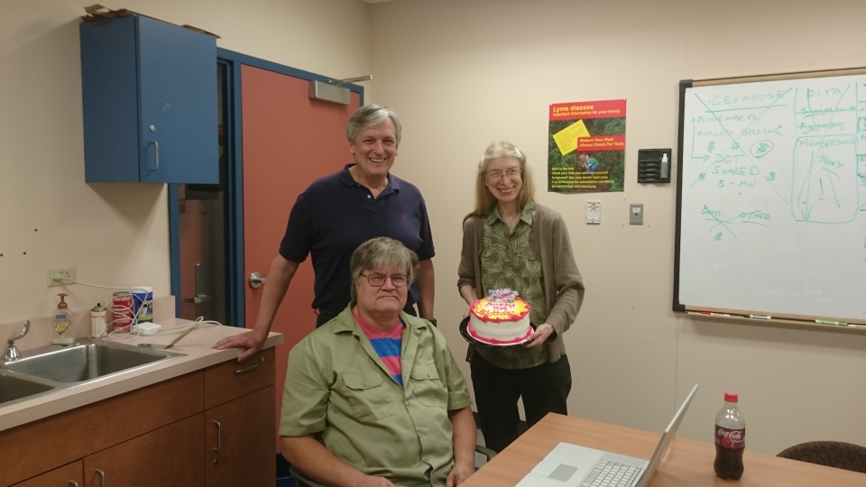
In a lighthearted moment after escaping the rigors of the planning whiteboard, founding members of the SharedGeo Board of Directors, Bob Basques, Steve Swazee and Nancy Read, pause to enjoy SharedGeo’s 8th “birthday.” Founded on September 30th, 2008, business has continued to grow for an entity few thought would work – a nonprofit committed to helping “government, nonprofit, education, and corporate entities use mapping technologies and share geographic data for the public good.” Nunc rideam.

DragonEye Software Selected for MN Cup Competition

June 24, 2016 by central No Comments

On June 6th, SharedGeo was informed that its DragonEye location tracking software had been selected as a semifinalist for the 2016 MN Cup Competition.  The contest which is sponsored by the Carlson School of Management at the University of Minnesota brings together “entrepreneurs from across the state and connects them with education, mentorship and support to launch and accelerate the development of their new ventures.”  Conducted annually, the top winners of the competition split a purse of more than $450,000.

Out of approximately 1500 submissions, DragonEye was picked as a top 10 entry in the High Tech division.  Although DragonEye is a product which was initially developed to only support tracking of utility vehicles, over nearly 4 years of follow-on development it has evolved into a highly versatile platform primarily focused in the aviation sector where display accuracy and high data throughput rates are critical to safe operations.  Furthermore, across the several years of development, DragonEye has also gained the absolutely unique ability to receive and track every type of GPS enabled device.  You can play the promotional video for DragonEye by clicking this link

SharedGeo Sponsors United Nations SPIDER Training Event Hosted by Delta State University

November 14, 2015 by central No Comments


A 3-day training event for select Asia rim, Africa and South America emergency managers was recently hosted by Delta State University at Mississippi Emergency Management Agency spaces in Jackson, Mississippi.  Created in partnership with the United Nations Office for Outer Space Affairs, Platform for Space-based Information for Disaster Management and Emergency Response (SPIDER), the 20 attendees participated in training events which focused on how geospatial technology could be leveraged during disaster response operations.  SharedGeo was honored to be able to provide financial and administrative support to make the event a success. Through its support agreement with the Geospatial Information & Technology Association, it previously provided similar support to a United Nations event which took place in Hanoi, Vietnam during November 2014.

Notable attendees included SPIDER Far East Director Dr. Shirish Ravan, who SharedGeo hosted during his visit to the Twin Cities in July 2014.

You can read more about the Jackson, MS event at this link.