SharedGeo Supports GITA Minnesota-Wisconsin Conference

May 15, 2011 by central No Comments

SharedGeo was one of the sponsors of the “New and Emerging Spatial Technologies Seminar” May 3-4 organized by the Minnesota and Wisconsin Chapters of GITA. Bob Basques spoke on Open Source Geospatial Software in Government and Steve Swazee gave a presentation on the MnGeo Emergency Preparedness Committee. Steve also presented at the Apr. 10-13 GITA Geospatial Solutions national conference in Dallas where he spoke on two topics: the “Accelerating Integration of Infrastructure”, and the use of Geospatial Information Systems within the “Emergency Management Cycle”.

SharedGeo in Montreal Code Sprint

March 18, 2011 by Nancy No Comments

SharedGeo contributed to the Open Source community through the OSGeo Code Sprint in Montreal March 14-18, with programmer Jim Klassen working primarily on areas related to MapServer, including maintenance to Ruby bindings for both MapServer and OGR. For a general description of the work done (and photos of participants), check out Daniel Morissette’s blog at http://dmorissette.blogspot.com/, or the OSGeo site http://wiki.osgeo.org/wiki/Montreal_Code_Sprint_2011

SharedGeo Technical Director Named to Present at FOSS4G

February 18, 2011 by central No Comments

SharedGeo announced today that its Technical Director, Bob Basques, has been named as the lead presenter for a three-hour workshop at the Free and Open Source Software “4” Geospatial (FOSS4G) Conference in Denver during September 2011.  Bob will be conducting the workshop on GeoMoose, a product that he has used extensively which was developed during his tenure at the city of St. Paul, MN and released as Open Source through additional work funded by an FGDC grant .

Organized by the Open Source Geospatial Foundation, FOSS4G is considered to be the premier international event focused on Free and Open Source Software for Geospatial.  The conference is expected to draw over 1000 participants for its return to the North American continent for the first time in four years.

under a FGDC grant

SharedGeo Commences IT System Buildout to Support USFWS GLRI Project

December 14, 2010 by central No Comments

SharedGeo announced today it had commenced buildout of the information technology capabilities required to support the U.S. Fish and Wildlife Service’s (USFWS) participation in the Great Lakes Restoration Initiative (GLRI).  Upon completion of the first phase of the project, SharedGeo anticipates its servers will be hosting up to 50 TBs of wetland imagery for the Great Lakes basin.  As such, SharedGeo believes it will be creating the most comprehensive dynamic on-line inventory of remote sensing imagery for the area in existence.   Imagery will be made available to the public, academic, and research communities in support of a variety of efforts focused on restoring wetland habitat throughout the basin.  In addition to the USFWS and U.S. Environmental Protection Agency,  SharedGeo’s partners in the effort include Ducks Unlimited, University of Minnesota-Twin Cities, St. Mary’s University of Minnesota, and Michigan Technological University.

SharedGeo at GITA-Japan

December 8, 2010 by central No Comments

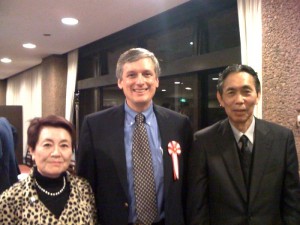
(L to R) Former U.N. interpetor Fumiko Oyama, SharedGeo Executive Director Steve Swazee, and GITA-Japan President, PhD Sakura Shinoaki

(L to R) Former U.N. interpreter Fumiko Oyama, SharedGeo Executive Director Steve Swazee, and GITA-Japan President, Professor Sakura Shinoaki

At the request of the Geospatial Information and Technology Association (GITA) of North America, SharedGeo Executive Director Steve Swazee delivered two presentations at the annual national convention of GITA-Japan, held at Toyko University on December 7th, 2010.  In addition to the annual update about GITA-North American operations, Steve presented on the efforts of the MnGeo Emergency Preparedness Committee, a Minnesota State committee that he chairs.  The presentation highlighted the many ways in which individuals in the state’s geospatial and emergency management communities have been working together to improve the delivery of situational awareness to responders during emergencies.