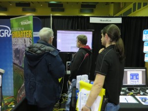
SharedGeo Goes to WLIA Conference
SharedGeo Executive Director, Steve Swazee, and Technical Director, Bob Basques, each gave presentations at the 27th annual Wisconsin Land Information Association (WLIA) conference February 12-14 at the Marriot Madison West in Middleton, Wisconsin. The conference focused on making the vision of Wisconsin’s GIS future into a reality and served as a platform to showcase the latest open source technology–including SharedGeo’s shared funding project, GeoMOOSE.
Executive Director Steve Swazee presented SharedGeo’s Minnesota Marker Project: “U.S. National Grid Trail Markers — Bringing Geo-location to a Trail Near You!” The presentation discussed the technical and practical considerations for deploying the USNG marker system, and the ways it enhances safety and emergency response in recreational areas, like parks and trails. Mr. Swazee also talked about how markers have been deployed in Minnesota’s Arrowhead region, and how the markers are being considered for statewide adoption by snowmobile clubs and other outdoor enthusiasts.
Technical Director Bob Basques’s presentation highlighted SharedGeo’s Automatic Vehicle Locating (AVL) system. Basques discussed how the AVL system was built using GeoMOOSE, OpenLayers web clients, Mapserver, and the PostgreSQL database, and why the team chose to build their own web viewer instead of a commercial package. Mr. Basques also demonstrated AVL production services in a live view mode.
Both workshops were well attended, and SharedGeo’s booth in the exhibition hall experienced heavy traffic with conference-goers expressing strong interest in SharedGeo’s open source software, GeoMOOSE, Mr. Basques’s AVL project, and the USNG Minnesota marker project. You can learn about GeoMOOSE, the AVL project, or the USNG Minnesota marker project and all our other projects on the SharedGeo website.


No comments